Cordillera Real Traverse

Distance: 150 km
Duration: 9 days
Country:
The Cordillera Real Traverse takes you through Bolivia's most stunning mountain range, offering unparalleled views of glaciated peaks and azure high-altitude lakes. This trek is a hidden gem, far less crowded than similar routes in the Andes, providing a sense of solitude and connection with the natural world.

Distances

  • 9days, 150 km, 5,295 m high point

Route

  • through hike
  • starting in Sorata
  • ending in Condoriri Valley
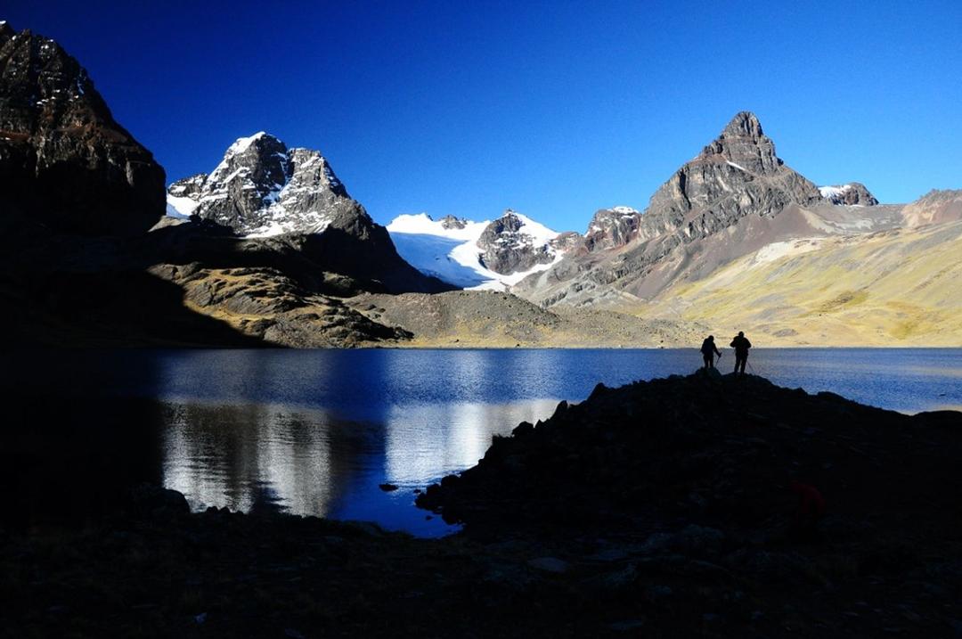
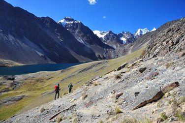
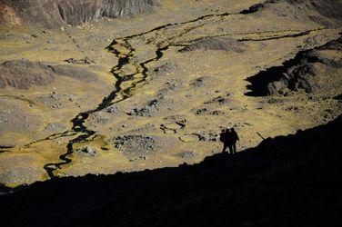
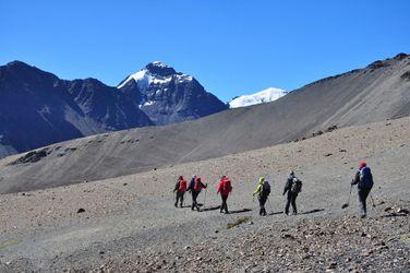
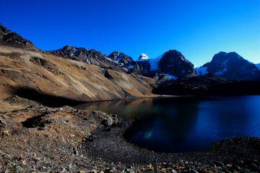
A challenging trek across the stunning Cordillera Real mountain range in Bolivia.
Day 1

Sorata to Alto Llojena (4,050 m)

Distance: 10 kmTime trekking / climbing: 5 hoursElevation change: +103 m
Begin the trek by hiking from Sorata to Alto Llojena.
Day 2

Alto Llojena to San Francisco lagoon (4,639 m)

Distance: 12 kmTime trekking / climbing: 7 hoursElevation change: +589 m
Continue the trek, enjoying breathtaking views along the way.
Day 3

San Francisco lagoon to Chojna Kota (4,685 m)

Distance: 11 kmTime trekking / climbing: 5 hoursElevation change: +46 m
In this route, water is typically so abundant that the marshy grasslands essentially blanket the entire valley from one side to the other, posing a significant challenge when attempting to cross the relatively short distance to the opposite side.
Day 4

Chojna Kota to Jistaña Lagoon (4,629 m)

Distance: 7 kmTime trekking / climbing: 4 hoursElevation change: -56 m
Following an exhilarating and steep descent, we'll enter a peculiar and stunningly colorful hanging valley.
Day 5

Jistaña Lagoon to Kelluani Valley (4,609 m)

Distance: 8 kmTime trekking / climbing: 5 hoursElevation change: -20 m
You will start the day ascending and traversing on a steep slope following narrow llama paths.
Day 6

Trek to Chachacomani River (4,426 m)

Distance: 10 kmTime trekking / climbing: 7 hoursElevation change: -183 m
This day is likely to be one of the most physically demanding of the trek, as you'll be ascending to the highest point on the itinerary. It unquestionably provides one of the most extraordinary viewpoints in the entire Cordillera Real.
Day 7

Rest day

Take advantage of a well-deserved rest day to rejuvenate yourselves, preparing for the challenges of the upcoming mountain passes.
Day 8

Trek to Jaillawaya River (4,622 m)

Distance: 12 kmTime trekking / climbing: 7 hoursElevation change: +196 m
The ascent is characterized by a steep slope, faint trails, and terrain consisting of loose pebbles and sand.
Day 9

Jaillawaya to Koatia (4,439 m)

Distance: 19 kmTime trekking / climbing: 8 hoursElevation change: -183 m
Today, you'll follow a direct ascending path leading to a vast rocky cirque carved by the western slopes of Wara Warani Mountain, home to a stunning glacial lake.
Day 10

Trek to Laguna Alka Quota (4,531 m)

Distance: 15 kmTime trekking / climbing: 7 hoursElevation change: +92 m
The upcoming route for the following days is a segment of the renowned 'Transcordillera' trek, and you can expect the trails to be predominantly broad and well-defined.
Day 11

Laguna Alka Quota to Juri Kota lake (4,695 m)

Distance: 13 kmTime trekking / climbing: 6 hoursElevation change: +164 m
You'll need to cross two passes back-to-back: Paso Sistaña and Paso Jurikhota.
Day 12

Juri Kota lake to Laguna Chiar Khota (4,650 m)

Distance: 9 kmTime trekking / climbing: 6 hoursElevation change: -45 m
Ascending to today's mountain pass involves navigating between the rugged peaks of Cerro Ventanani and Janchallan.
Day 13

Laguna Chiar Khota to Condoriri Valley (4,400 m)

Distance: 2 kmTime trekking / climbing: 2 hoursElevation change: -250 m
You will commence your journey towards the last segment of the trek, leading you down to the entrance of the Condoriri Valley.

A very approximate route. Typically hiked from north to south.

The trek is 7 / 10, based on the below factors:

Terrain & route condition 7 / 10

Treks that involve rugged or uneven terrain, such as rocky paths, scree slopes, or dense forests, may require more technical skills or physical effort.

Altitude / Elevation 8 / 10

Considering the maximum altitude reached during the trek. Higher altitudes can present challenges like thin air, low oxygen levels, and potential altitude sickness.

Distance 8 / 10

The total distance of the trek. Longer treks generally require more endurance and physical fitness.

Elevation gain 7 / 10

Total elevation gain throughout the trek. Treks with significant altitude changes can be more challenging, especially if they involve steep ascents or descents.

Technical difficulty 5 / 10

Some treks may require basic technical skills like river crossings, using ropes, or scrambling over rocks.

Access to facilities / Remoteness 8 / 10

Based on the availability of support facilities such as accommodation, food, water sources, and emergency services. Treks with limited infrastructure or remote areas can be more challenging due to self-sufficiency requirements. The less support facilities there are the harder the trek.

Climate & weather 6 / 10

How tough are the prevailing weather and climate conditions during the trek. Harsh weather, extreme temperatures, or unpredictable conditions can add to the difficulty.

Cordillera Real Traverse Links

useful websites, Groups and communities

Groups / links with more info on the Cordillera Real Traverse route.